Thursday, June 12, 2014

The Land of Lincoln

Before I tell you about my day crossing Illinois, I need to show you two more pics from Indiana--and one of them is the best one I took there!!!


I was in Valparaiso, and they had a nice public park with a big stage that seemed to be ready for a concert in the near future.  But by the main street under a shelter was a statue that I just HAD to have my picture made beside!  This is Orville Redenbacher, the popcorn guy, who was raised here.


The last mile of the Lincoln Highway in Indiana is what the founders of the road called the Ideal Section.  It was four-laned with lights for night driving and a greenspace area on one side of the road for hiking.  They hoped communities around the country would build similar stretches.  This stretch of the highway in Dyer, Indiana, is pretty busy, but I did walk down the shoulder to look at the Henry Ostermann Monument.  He was the Field Secretary of the early Lincoln Highway Association, and he was actually killed in an accident along the road.  This is a tribute to him.  When I got there, I wasn't actually sure if I had found it; it had been stripped of all of its markers.  I don't know if it's vandalism, or if somebody is trying to restore it.  But I'm pretty sure I was in the right place.  Some of you Lincoln Highway enthusiasts can tell me if I just didn't find the right place or not.
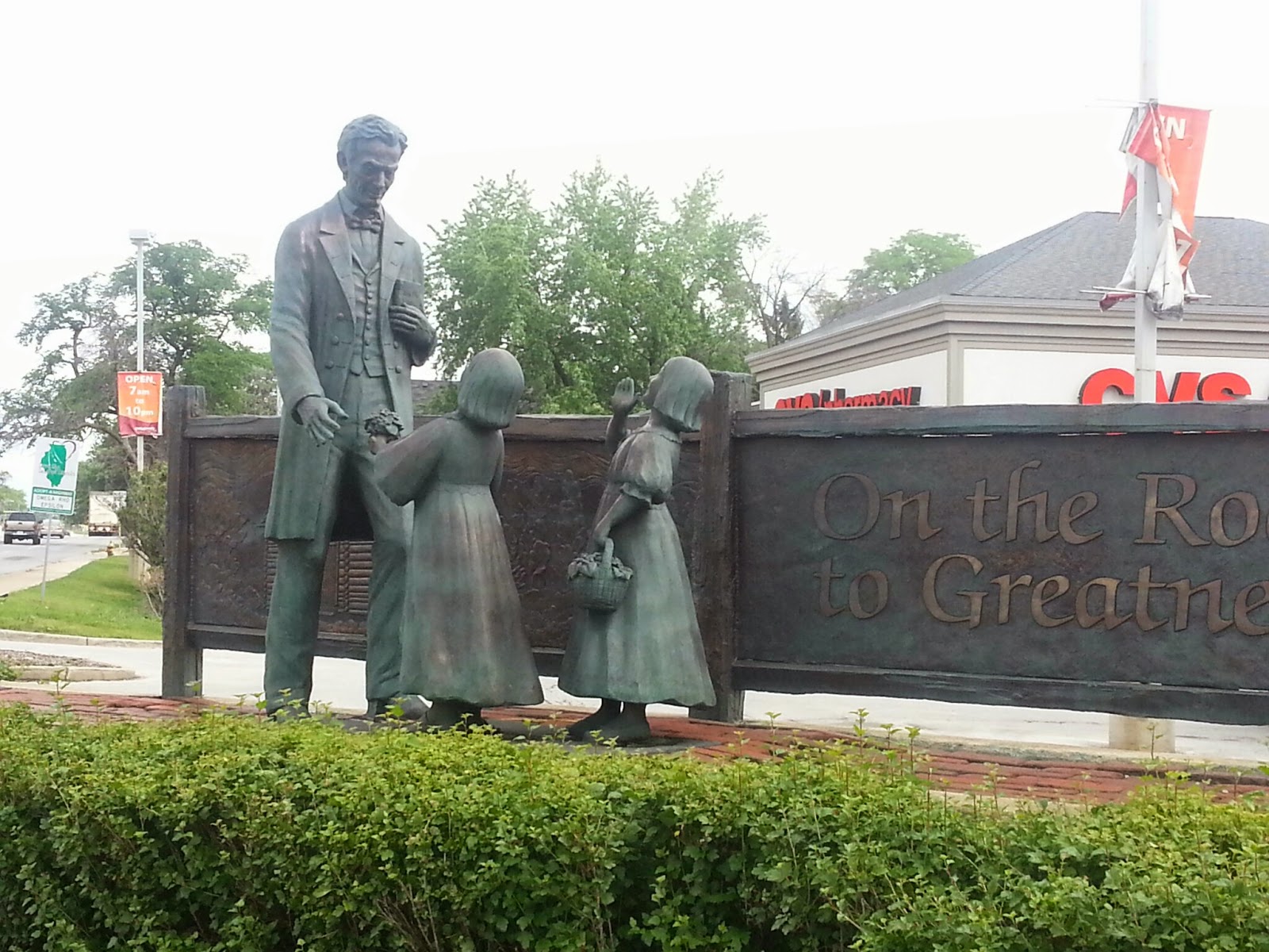


In Chicago Heights, Illinois, is where the Lincoln Highway (east-west) met the Dixie Highway (north-south).  Us Southerners see signs for the Dixie Highway on US 1 and US 41 in our neck of the woods.  At the place where these two great roads crossed, a statue of Lincoln with two little girls is found, as well as a Lincoln Highway fountain.


DeKalb, Illinois, had a great little park with an art-deco-looking Lincoln Highway marker and a cool information gazebo.


West of there, in a little place called Malta, was the first "seedling mile" of the Lincoln Highway.  The founders, who included not only automobile and parts manufacturers but also those who promoted highway-building materials, built these one-mile stretches throughout the Midwest and West where there weren't many paved roads at all.  This was to show how great concrete was for driving and encourage road building by governments.
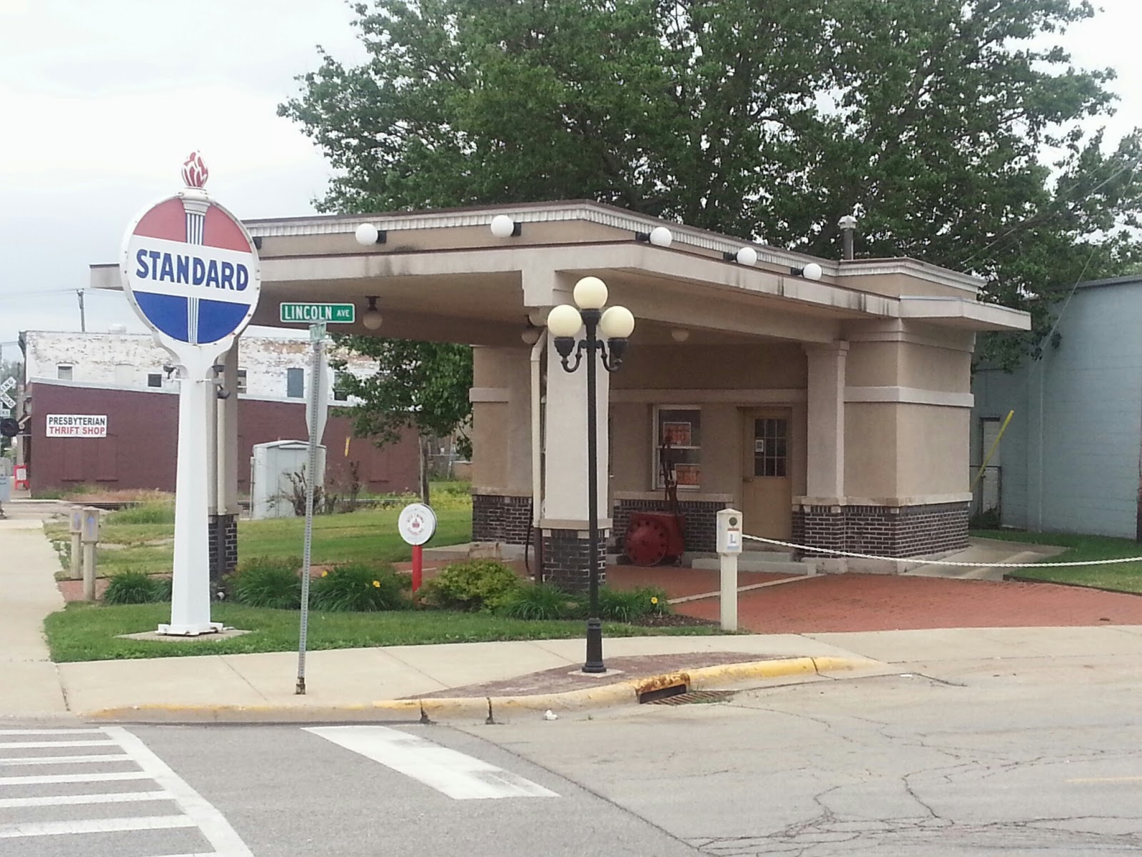


This restored service station, at a place where the LH turns right in Rochelle, is a Lincoln Highway information center.


Franklin Grove, Illinois, is the home of the Lincoln Highway Association's National Headquarters.  It's in a building built by a relative of Abraham Lincoln, and it has all kinds of LH merchandise.  I was too late; it was closed for the day.


Dixon, Illinois, is the hometown of President Ronald Reagan.  I visited his boyhood home, where there's a cute park with a statue of him looking very presidential, but friendly.  Then I took Reagan Way a few blocks to the banks of the Rock River, where he was a young lifeguard.  There, a statue has been erected that has a young Reagan on a horse.


About five miles northeast of Dixon is a place called Grand Detour.  This is where John Deere developed the steel plow.  Apparently, the soil in this part of the world kept wearing out cast-iron plows, and Deere was a blacksmith.  The eventual headquarters of the farm machinery company was placed in Moline, Illinois, a transportation hub on the Mississippi River not too far away.


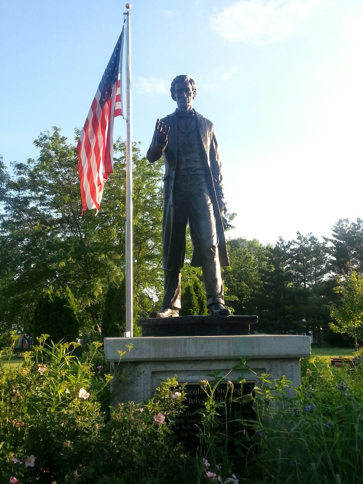


In a park in Sterling is a statue of Lincoln as he would have appeared in the Lincoln-Douglas debates.  A friend of his asked him and John C. Fremont, two of the earliest Republicans, to come speak in his town in 1856.


As the day was ending, I crossed the Mississippi River into Clinton, Iowa.  This is my first look at this great river, but I think it's a lot wider the farther south you go.  There was a big windmill beside the bridge on the Illinois side, where a town called Fulton is located.  Seems the place was settled by the Dutch.


Looking forward to Iowa!!!

Wednesday, June 11, 2014

The Lincoln Highway in Indiana

I crossed Indiana today.


On the road this morning, I stopped in the town of Ligonier at a convenience store.  Yes, Pennsylvania had a place called that, too.  The downtown area in this Indiana city was full of eye-catching murals.


As I drove toward Goshen, I saw these old log tourist cabins.  They had long closed, but these were typical of the pre-motor-hotel types of lodging establishments along the highway.  Before they came into existence, people just camped by the road or in public parks.


At the place where the Lincoln Highway takes a left turn in downtown Goshen, there is a remnant of the "gangster" days.  This police kiosk was actually used to watch out for gangsters on the highway and to shoot it out with them if necessary.


The older route of the LH in Indiana goes on a more northerly course through South Bend, the home of Notre Dame University.  I stopped to see if I could spot the famous "Golden Dome" and the ND football stadium.  I saw both, but a lot of construction only allowed me to get photos of the football stadium.  The gates to the stadium are named for coaches, and I was near the Frank Leahy Gate.  On the right, you can see the likeness of the Lord, painted on the library, which is visible over the north end zone stands.  Fans refer to the painting as "Touchdown Jesus" because of his uplifted arms.


One very attractive small town was New Carlisle.  In a beautiful downtown area, they had a Lincoln Highway kiosk which gave info about the history of the highway in their county.


On the Lincoln Highway documentary on PBS, a guy working with the Indiana LH Association takes the narrator on a drive to show how parts of the old highway "branch off" from the modern Route 33.  He takes them down Oak Knoll Road, part of the original LH.  I took a drive on the road myself this afternoon.


The city of LaPorte, which gets its name from the French for "gateway" (it was the gateway between two dense forests into fur trading country), had a restored, functional railroad depot.  In front of it was another information kiosk, which also had a plaque with a Lincoln Highway poem, written by the county's poet laureate.


Here are some of the examples of LH signs I saw today, all pointing the way for motorists.


Spent the night in Merrillville, IN, close to Chicago.  There was fog coming off Lake Michigan.  I had always heard that Indiana was crazy about their time zones; it is true.  They are actually in the East, but apparently parts of the state want to be on the same clock as Chicago (Central time).  I was totally confused.

Monday, June 9, 2014

Pro football, two presidents, and the Old Lincoln Highway

Since I stayed in Canton, Ohio last night, I was very close to two sites.  The first of these was the William McKinley Memorial and Presidential Library.  McKinley was President during the Spanish-American War, and he was assassinated in Buffalo, New York in 1901.  This is when Theodore Roosevelt became President.  McKinley is considered the first Chief Executive to basically "run the White House" the way it basically operates today, with an executive staff that serves the President and handles public relations.  This huge, stately monument, which was a mausoleum for the immediate family, sees a lot of use each day because of its innumerable STEPS.  Fitness freaks from all over Canton come here to strain their muscles.

Next I visited the Pro Football Hall of Fame.  Since the NFL began in Canton, the sport's shrine is located here.  Each year, a "class" of inductees joins those already enshrined, and their busts are placed in the Hall.  There are history exhibits, interactive experiences (I pretended to be a referee and looked at an instant replay--and I got the call right!), and many pieces of equipment and uniforms from stars of the past.  For sports fans, it's a can't-miss!


Bust of Lamar Hunt, the founder of
the AFL and the Kansas City Chiefs
Jerseys worn by Larry Csonka and
Lynn Swann in Super Bowl games

After seeing the Canton sites, I traveled west on the Old Lincoln Highway.  In many places, the roads of the original route are still in use, and Ohio did a good job of marking the route with a series of brown signs with the "L" logo in red, white, and blue.  This symbol was painted on light poles and other posts, and signs soon followed with the same paint scheme.  This, along with guide books, was the way in which early motorists navigated the Lincoln Highway in the 19-teens and twenties.  After about 20 years, the national highway system adopted the number system it still uses today.  The following pictures give you examples of the kind of signage along the Old Lincoln Highway.


Near a place called Riceland, the Smuckers company developed.  After starting as a producer of apple-related products like apple butter, they soon worked their way into the jam/jelly market.  The family continued to develop the brand, eventually acquiring others like Pillsbury, Hungry Jack, Jif, Folgers, and more.  Just off the Lincoln Highway, they have a store/museum.  


I took a detour to Marion, Ohio, south of the LH, to see the historic sites related to President Warren G. Harding.  Harding, a newspaper man, eventually entered politics and became Lt. Governor of Ohio before becoming the "compromise presidential candidate" on the tenth ballot of the 1920 Republican Convention.  He basically conducted the entire campaign from the front porch of his home in Marion, the last such campaign for President.  In 1923, he took a trip to California and Alaska.  He had a heart attack in San Francisco, where he died.  Calvin Coolidge then became President.  I saw Harding's monument/gravesite in Marion, as well as the house.


Other things on the road today...
Ice Cream shop in Massillon, OH
Had lunch at Coney Island Diner in Mansfield, OH
Dramatic mural on the town square in Bucyrus, OH