Friday, June 13, 2014

Welcome to Iowa!

My first day in Iowa began with a visit to the Herbert Hoover Presidential Library and Museum.  This is located south of the Lincoln Highway in West Branch, where Hoover was born.  Even though he was orphaned as a child and sent to live with relatives in Oregon, he still considered this his home.  Though Hoover is still associated with the Great Depression, his accomplishments in life were actually remarkable.  He became a millionaire in the mining business, then headed up efforts to feed starving people both during and after World War I.  The southern part of the small town of West Branch is devoted to the museum, and many of the homes and buildings from Hoover's days there have been preserved and moved to the grounds of the museum.  He and his wife Lou are buried on a pretty hillside there.


Here are some Lincoln Highway markers and exhibits I saw along the way today.  The concrete posts were erected by the Boy Scouts and the Lincoln Highway Association in 1927, and they were supposed to mark the way "permanently."  Some of them have been relocated, but many remain in their original positions.
Front yard in Lisbon
Site of old LH bridge removed for
newer highway

The Abbe Creek School near Mt. Vernon,
named for first prominent settler of area

I got off the road early today, stopping in Cedar Rapids.  I went to a minor league baseball game, and the Cedar Rapids Kernels (yes, they're named for corn) took on the Quad Cities River Bandits.  This is what's called the Mid West League.


Thursday, June 12, 2014

The Land of Lincoln

Before I tell you about my day crossing Illinois, I need to show you two more pics from Indiana--and one of them is the best one I took there!!!


I was in Valparaiso, and they had a nice public park with a big stage that seemed to be ready for a concert in the near future.  But by the main street under a shelter was a statue that I just HAD to have my picture made beside!  This is Orville Redenbacher, the popcorn guy, who was raised here.


The last mile of the Lincoln Highway in Indiana is what the founders of the road called the Ideal Section.  It was four-laned with lights for night driving and a greenspace area on one side of the road for hiking.  They hoped communities around the country would build similar stretches.  This stretch of the highway in Dyer, Indiana, is pretty busy, but I did walk down the shoulder to look at the Henry Ostermann Monument.  He was the Field Secretary of the early Lincoln Highway Association, and he was actually killed in an accident along the road.  This is a tribute to him.  When I got there, I wasn't actually sure if I had found it; it had been stripped of all of its markers.  I don't know if it's vandalism, or if somebody is trying to restore it.  But I'm pretty sure I was in the right place.  Some of you Lincoln Highway enthusiasts can tell me if I just didn't find the right place or not.
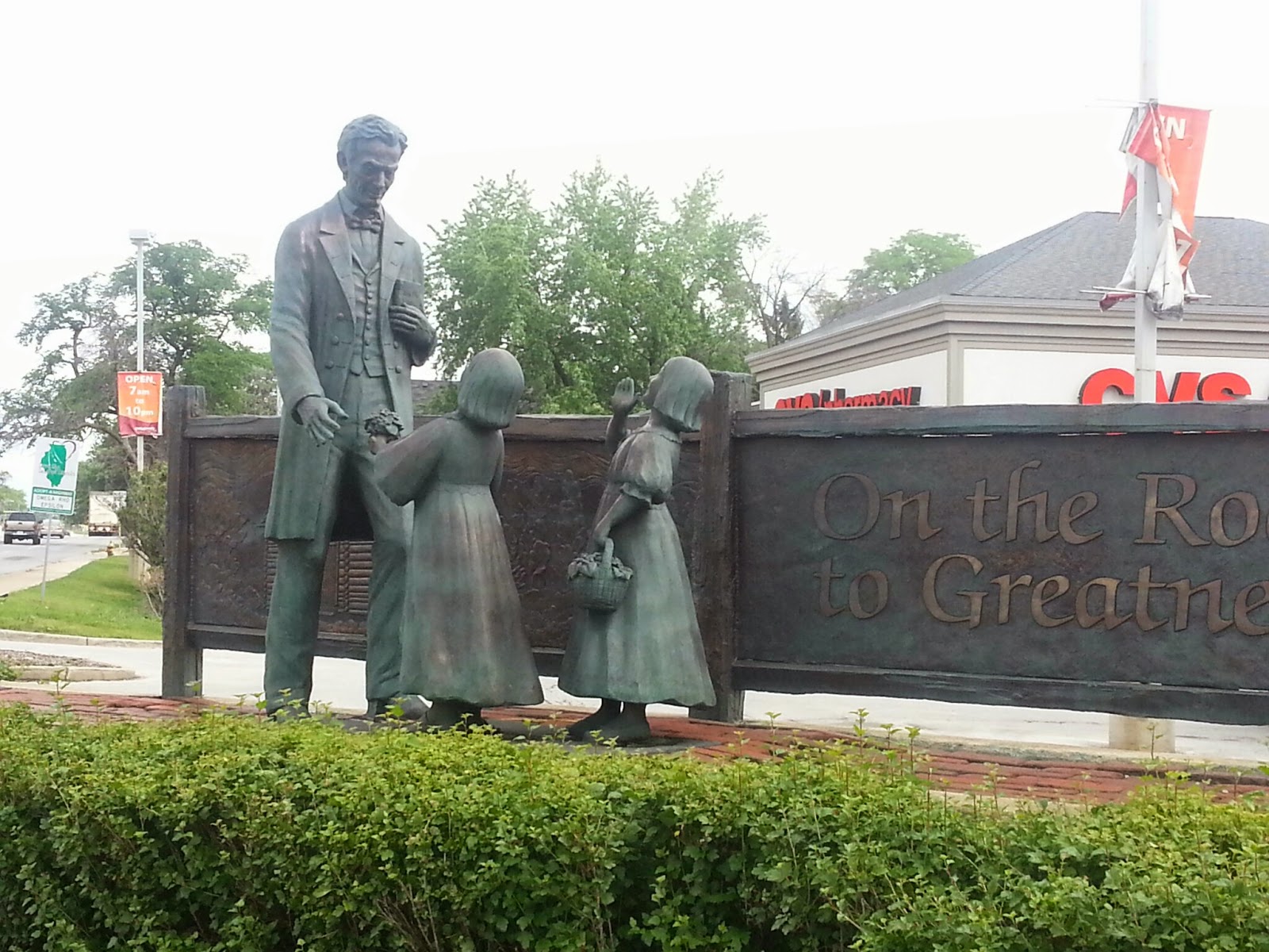


In Chicago Heights, Illinois, is where the Lincoln Highway (east-west) met the Dixie Highway (north-south).  Us Southerners see signs for the Dixie Highway on US 1 and US 41 in our neck of the woods.  At the place where these two great roads crossed, a statue of Lincoln with two little girls is found, as well as a Lincoln Highway fountain.


DeKalb, Illinois, had a great little park with an art-deco-looking Lincoln Highway marker and a cool information gazebo.


West of there, in a little place called Malta, was the first "seedling mile" of the Lincoln Highway.  The founders, who included not only automobile and parts manufacturers but also those who promoted highway-building materials, built these one-mile stretches throughout the Midwest and West where there weren't many paved roads at all.  This was to show how great concrete was for driving and encourage road building by governments.
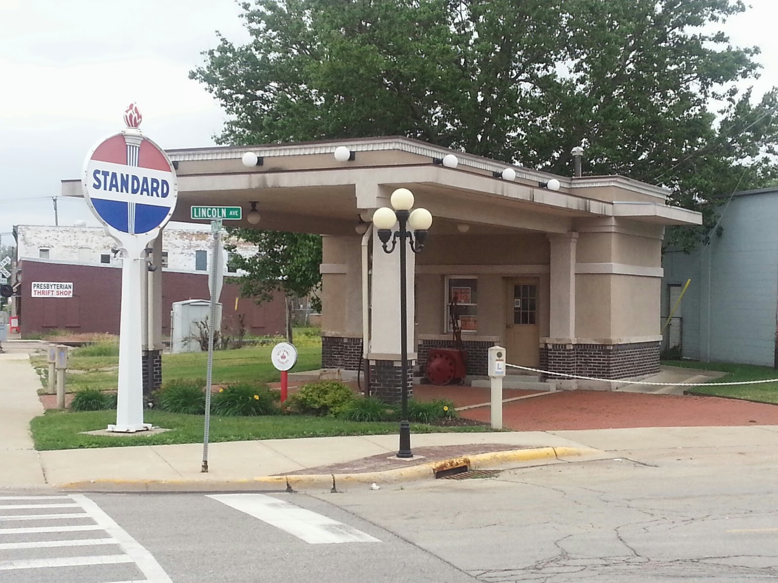


This restored service station, at a place where the LH turns right in Rochelle, is a Lincoln Highway information center.


Franklin Grove, Illinois, is the home of the Lincoln Highway Association's National Headquarters.  It's in a building built by a relative of Abraham Lincoln, and it has all kinds of LH merchandise.  I was too late; it was closed for the day.


Dixon, Illinois, is the hometown of President Ronald Reagan.  I visited his boyhood home, where there's a cute park with a statue of him looking very presidential, but friendly.  Then I took Reagan Way a few blocks to the banks of the Rock River, where he was a young lifeguard.  There, a statue has been erected that has a young Reagan on a horse.


About five miles northeast of Dixon is a place called Grand Detour.  This is where John Deere developed the steel plow.  Apparently, the soil in this part of the world kept wearing out cast-iron plows, and Deere was a blacksmith.  The eventual headquarters of the farm machinery company was placed in Moline, Illinois, a transportation hub on the Mississippi River not too far away.
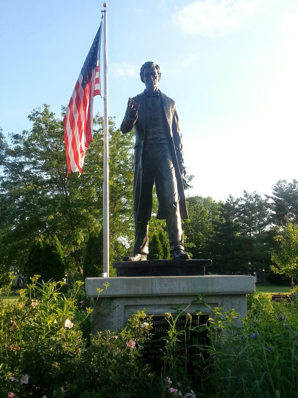


In a park in Sterling is a statue of Lincoln as he would have appeared in the Lincoln-Douglas debates.  A friend of his asked him and John C. Fremont, two of the earliest Republicans, to come speak in his town in 1856.


As the day was ending, I crossed the Mississippi River into Clinton, Iowa.  This is my first look at this great river, but I think it's a lot wider the farther south you go.  There was a big windmill beside the bridge on the Illinois side, where a town called Fulton is located.  Seems the place was settled by the Dutch.


Looking forward to Iowa!!!

Wednesday, June 11, 2014

The Lincoln Highway in Indiana

I crossed Indiana today.


On the road this morning, I stopped in the town of Ligonier at a convenience store.  Yes, Pennsylvania had a place called that, too.  The downtown area in this Indiana city was full of eye-catching murals.


As I drove toward Goshen, I saw these old log tourist cabins.  They had long closed, but these were typical of the pre-motor-hotel types of lodging establishments along the highway.  Before they came into existence, people just camped by the road or in public parks.


At the place where the Lincoln Highway takes a left turn in downtown Goshen, there is a remnant of the "gangster" days.  This police kiosk was actually used to watch out for gangsters on the highway and to shoot it out with them if necessary.


The older route of the LH in Indiana goes on a more northerly course through South Bend, the home of Notre Dame University.  I stopped to see if I could spot the famous "Golden Dome" and the ND football stadium.  I saw both, but a lot of construction only allowed me to get photos of the football stadium.  The gates to the stadium are named for coaches, and I was near the Frank Leahy Gate.  On the right, you can see the likeness of the Lord, painted on the library, which is visible over the north end zone stands.  Fans refer to the painting as "Touchdown Jesus" because of his uplifted arms.


One very attractive small town was New Carlisle.  In a beautiful downtown area, they had a Lincoln Highway kiosk which gave info about the history of the highway in their county.


On the Lincoln Highway documentary on PBS, a guy working with the Indiana LH Association takes the narrator on a drive to show how parts of the old highway "branch off" from the modern Route 33.  He takes them down Oak Knoll Road, part of the original LH.  I took a drive on the road myself this afternoon.


The city of LaPorte, which gets its name from the French for "gateway" (it was the gateway between two dense forests into fur trading country), had a restored, functional railroad depot.  In front of it was another information kiosk, which also had a plaque with a Lincoln Highway poem, written by the county's poet laureate.


Here are some of the examples of LH signs I saw today, all pointing the way for motorists.


Spent the night in Merrillville, IN, close to Chicago.  There was fog coming off Lake Michigan.  I had always heard that Indiana was crazy about their time zones; it is true.  They are actually in the East, but apparently parts of the state want to be on the same clock as Chicago (Central time).  I was totally confused.